USGS operates a stream gauge at the Hacienda Bridge, which is just downstream from here. The data is posted on the web in real time.
Taking the final difference in elevation, between a mark on the stairs down to the river and the slab inside the basement door.
However, I didn’t know what gauge elevation corresponds to the waters reaching my house.
Now I do know, I think, fairly accurately. That will help next time, especially if I’m looking at the stream gauge data remotely, or at night.
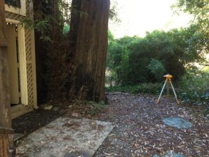
Here’s how I calibrated the gauge to my house: I found the high water mark from the most recent event (an obvious mark on the path down to the river), and used a construction level to measure the difference in elevation to my basement slab. This took two setups of the instrument. I make a crude sketch as I went along.
The flood crest at the Hacienda gauge was 29.77 feet, and the basement slab is 9.7 feet above the high water mark. Adding those together, I get 39.5 feet, a number I hope I won’t be watching for anytime soon. That 9.7 feet might seem like a lot–except that in this relatively minor event, the river rose more than 20 feet, at a rate of about a foot an hour.
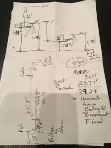
A crude sketch, good enough notes for my purpose.
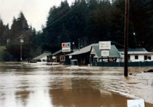
1986 flood at Forest Hills market, a block away from me, and on higher ground.
Fortunately, the house’s first floor elevation is a little more than 12 feet above the basement slab–higher than the floodwaters reached in 1986.
But you never know.